File:1984 - Fictitious world map.svg
From WikiMANNia Commons

Size of this PNG preview of this SVG file: 800 × 406 pixels. Other resolution: 320 × 162 pixels.
Original file (SVG file, nominally 2,212 × 1,123 pixels, file size: 559 KB)
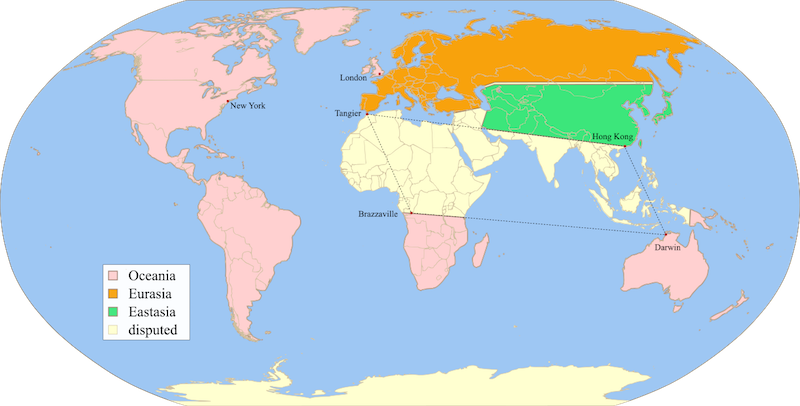
Deutsch: Fiktive Karte, die die politische Landschaft von Orwells 1984 zeigt.
- Description
- Fictitious map, illustrating the political landscape of Orwell's Nineteen Eighty-Four[wp], based on 1984 fictious world map v2 quad.png[ext], rendered from 1984 fictious world map v2.svg[ext], inspired by 1984 fictious world map.png[ext] and 1984 Orwell arrows 2.png[ext], based on File:BlankMap-World6.svg[ext], created following Wikipedia's map color standard.
- Date
- 21 March 2008
- Source
- Twisp[ext]
- Author
- MichaelsProgramming[ext]
- PNG-Version (deutsch)
- File:1984 - Fiktive Weltkarte.png
This file is translated using SVG
<switch> elements. All translations are stored in the same file! Learn more.
To embed this file in your language (if available) use the |
File history
Click on a date/time to view the file as it appeared at that time.
| Date/Time | Thumbnail | Dimensions | User | Comment | |
|---|---|---|---|---|---|
| current | 04:23, 9 November 2018 | | 2,212 × 1,123 (559 KB) | Werner (talk | contribs) | add switch |
You cannot overwrite this file.
File usage
There are no pages that use this file.
