File:Liberation Kramatorsk agglomeration.svg
From WikiMANNia Commons

Size of this PNG preview of this SVG file: 562 × 599 pixels. Other resolutions: 225 × 240 pixels | 450 × 480 pixels | 563 × 600 pixels | 720 × 768 pixels | 960 × 1,024 pixels | 677 × 722 pixels.
Original file (SVG file, nominally 677 × 722 pixels, file size: 50 KB)
Any autoconfirmed user can overwrite this file from the same source. Please ensure that overwrites comply with the guideline.
Summary
| Description |
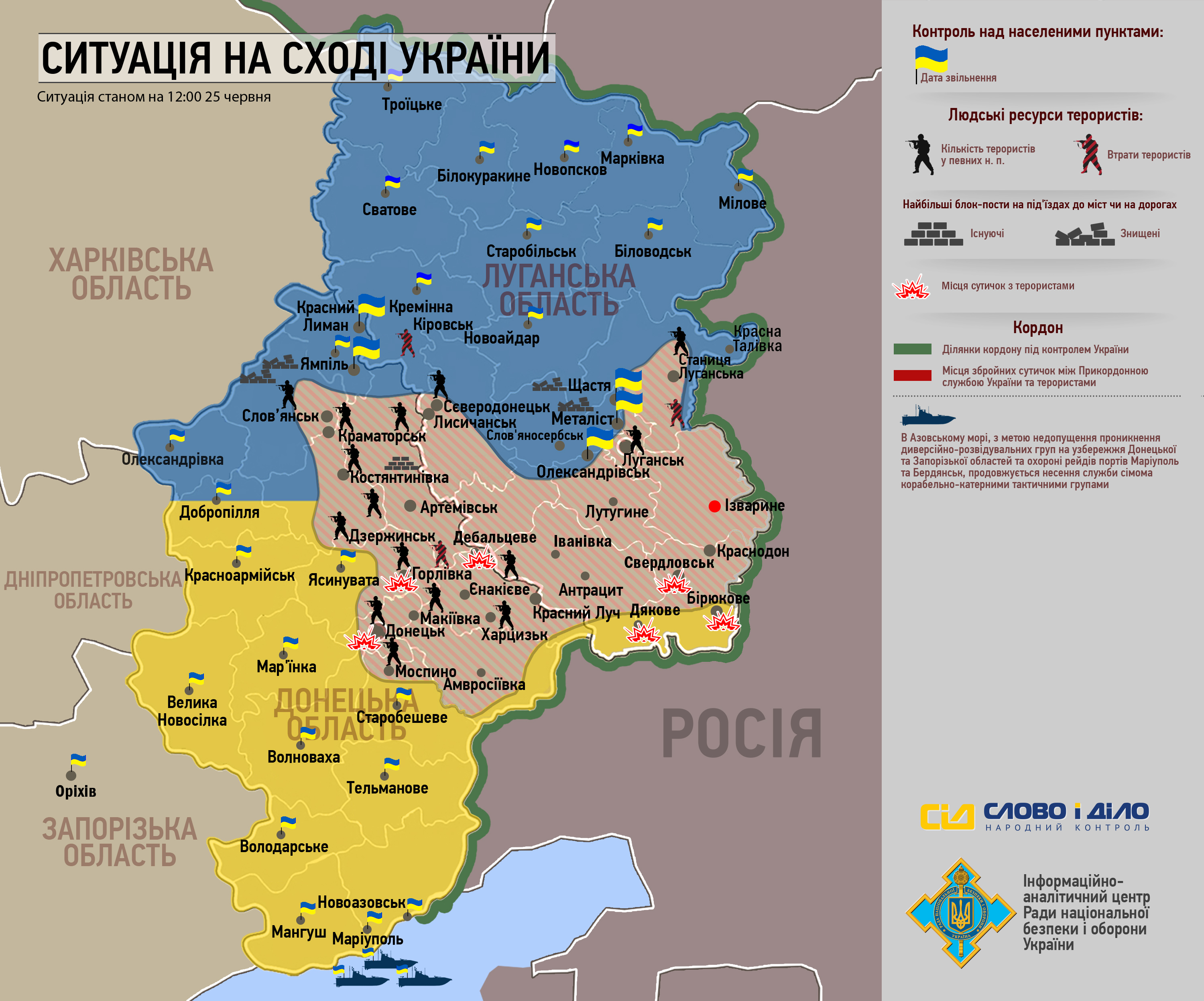
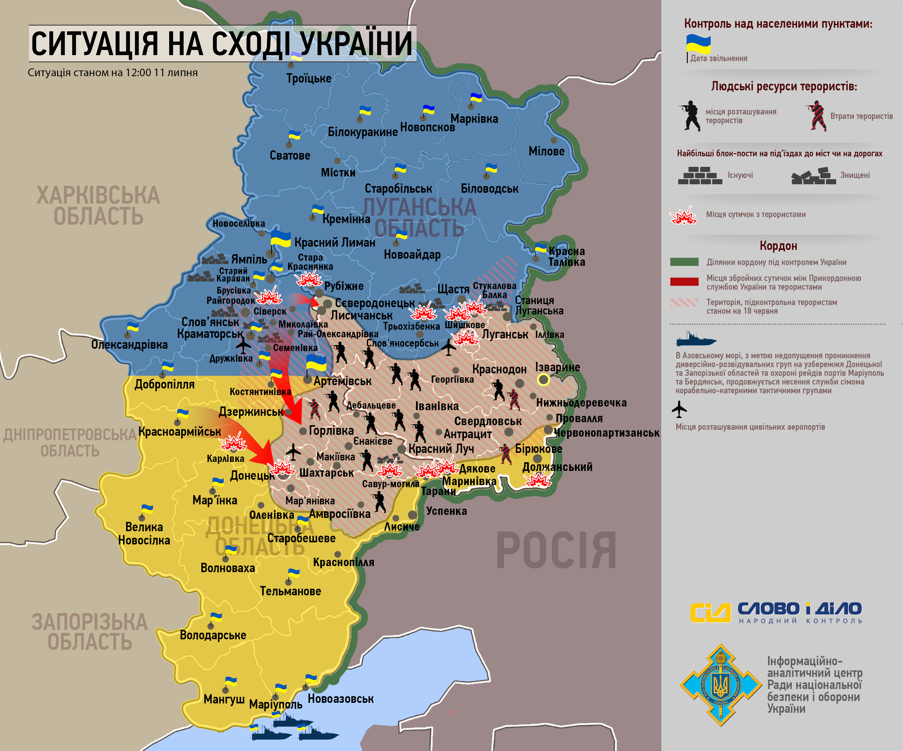
Deutsch: Karte der Kämpfe um Kramatorsk, Slowjansk, Druschkiwka und Kostjantyniwka während des Krieges im Donbass (2014)
English: Map battle for Kramatorsk, Sloviansk, Druzhkivka, and Kostiantynivka during the war in the Donbass (2014)
Español: Mapa de la batalla por Kramatorsk, Slóviansk, Druzhkivka y Kostantínovka durante la guerra en Dombás (2014)
Français : Carte des combats pour Kramatorsk, Sloviansk, Droujkivka et Kostiantynivka pendant la guerre dans le Donbass (2014)
Русский: Карта боевых действий за Краматорск, Славянск, Дружковку и Константиновку во время войны в Донбассе (2014)
Українська: Карта боїв за Краматорськ, Словянськ, Дружківку та Костянтинівку під час війни на Донбасі (2014)
|
| Date | |
| Source |
Own work Derivated from; This file was derived from: Withdrawal from Debaltseve.svg |
| Author | Goran tek-en |
| Other versions |
|
| SVG development | This map was created with a text editor. This map is translated using SVG switch elements: all translations are stored in the same file. |


| Object location | | View this and other nearby images on: OpenStreetMap |
|---|


Licensing
This file is licensed under the Creative Commons Attribution-Share Alike 4.0 International license.
Attribution:
Goran tek-en
- You are free:
- to share – to copy, distribute and transmit the work
- to remix – to adapt the work
- Under the following conditions:
- attribution – You must give appropriate credit, provide a link to the license, and indicate if changes were made. You may do so in any reasonable manner, but not in any way that suggests the licensor endorses you or your use.
- share alike – If you remix, transform, or build upon the material, you must distribute your contributions under the same or compatible license as the original.
File history
Click on a date/time to view the file as it appeared at that time.
| Date/Time | Thumbnail | Dimensions | User | Comment | |
|---|---|---|---|---|---|
| current | 16:46, 1 September 2025 | | 677 × 722 (50 KB) | WikiForMen | translate more "he" |
File usage
There are no pages that use this file.
