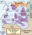
File:Livland 1260.png
Aus WikiMANNia Commons

Größe dieser Vorschau: 553 × 599 Pixel. Weitere Auflösungen: 222 × 240 Pixel | 443 × 480 Pixel | 554 × 600 Pixel | 709 × 768 Pixel | 945 × 1.024 Pixel | 1.909 × 2.068 Pixel.
Originaldatei (1.909 × 2.068 Pixel, Dateigröße: 576 KB, MIME-Typ: image/png)
Dateiversionen
Klicke auf einen Zeitpunkt, um diese Version zu laden.
| Version vom | Vorschaubild | Maße | Benutzer | Kommentar | |
|---|---|---|---|---|---|
| aktuell | 01:25, 11. Jul. 2024 |  | 1.909 × 2.068 (576 KB) | Ulamm | {{Information |description= {{de|Politische Karte von Livland im Mittelalter, etwa 1260. {{legtab|#D7DFF3|Besitz des Schwertbrüderordens bzw. Deutschen Ordens (in Preußen) |#BF8DC6|Geistlicher Besitz}} }} {{en|Political map of the Medieval Livonia, circa 1260, along with surrounding areas: {{legtab|#D7DFF3|Possessions of the Sword Brothers (in Livonia) and the Teutonic Order (in Prussia) |#BF8DC6|Ecclesiastical possessions}}}} |source={{Own}}, using * {{cite book|first=Stephen|last=Turnbull|p... |
Dateiverwendung
Keine Seiten verwenden diese Datei.

