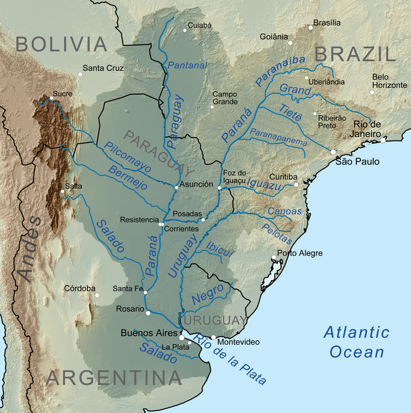
File:Riodelaplatabasinmap.png
From WikiMANNia Commons

Size of this preview: 596 × 600 pixels. Other resolutions: 238 × 240 pixels | 477 × 480 pixels | 763 × 768 pixels | 1,017 × 1,024 pixels | 1,500 × 1,510 pixels.
Original file (1,500 × 1,510 pixels, file size: 3.14 MB, MIME type: image/png)
File history
Click on a date/time to view the file as it appeared at that time.
| Date/Time | Thumbnail | Dimensions | User | Comment | |
|---|---|---|---|---|---|
| current | 18:43, 6 October 2010 |  | 1,500 × 1,510 (3.14 MB) | Kmusser | == Summary == {{Information |Description=Map showing the Río de la Plata drainage basin including major tributaries and cities. |Source={{own}}, Elevation data from SRTM, drainage basin from |
File usage
There are no pages that use this file.


