Category:Map
From WikiMANNia Commons
Media in category "Map"
The following 39 files are in this category, out of 39 total.
 1984 - Fiktive Weltkarte.png 1,106 × 560; 187 KB
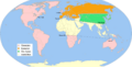
 All the countries the British never invaded.jpg 1,536 × 960; 109 KB
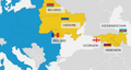 Belarus-Ukraine-Moldova - Georgia-Azerbaijan-Armenia.webp 550 × 293; 16 KB
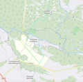 Bukyne-Synycheno - borders and road projects.webp 1,234 × 1,216; 86 KB
 Course of the Dnipro-Donbas Canal (de).webp 2,638 × 1,080; 295 KB
 Course of the Dnipro-Donbas Canal.webp 2,638 × 1,080; 280 KB
 Course of the North Crimean Canal and Kakhovka Canal.webp 1,814 × 1,266; 185 KB
 Deutschland im Groessenvergleich mit Afrika.jpg 966 × 814; 83 KB
 Economist Intelligence Unit Democracy Index.svg 2,192 × 1,135; 1.37 MB
 Ethno-linguistic map of Ukraine.webp 1,024 × 715; 101 KB
 Fluechtlinge aus Syrien.jpg 1,024 × 690; 84 KB
 Gulf of Mexico.webp 526 × 526; 58 KB
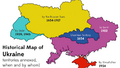 Historical Map of Ukraine - territories annexed, when and by whom.png 940 × 532; 133 KB
 ISW - Map of Ukrainian war as of March 16, 2025.webp 3,300 × 2,550; 493 KB
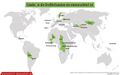
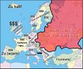 Karte der Zielstaaten.jpg 1,166 × 971; 190 KB
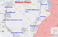 Kiev Defensive Lines in Donetsk Region.webp 1,456 × 931; 151 KB
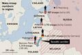 NATO troop contingents in the Baltic states (2022).jpg 1,280 × 853; 158 KB
 Oskil Reservoir - Kupiansk - Senkove - Borova - Pisky-Radkivski - Oskil.png 1,238 × 1,319; 1.72 MB
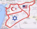 Partition of Syria.jpg 1,200 × 942; 142 KB
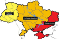
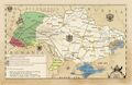
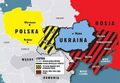 Partition of Ukraine (2015).jpg 680 × 471; 74 KB
 Partition of Ukraine (Kyiv Post).webp 904 × 598; 51 KB
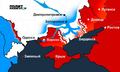
 Partitioned Russia after Putin.jpg 1,200 × 675; 86 KB
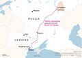 Pipeline transporting ammonia through Russia and Ukraine.jpg 875 × 623; 69 KB
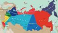
 Post Russia Forum - Northern Eurasia 2030.svg 512 × 286; 1.55 MB
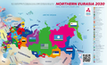 Post Russia Forum - Northern Eurasia 2030.webp 1,600 × 969; 154 KB
 River Oskil - Logachevka - Dvorichna - Kupiansk.png 1,486 × 1,426; 1.97 MB
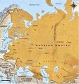 Russian Empire in the 19th century.jpg 728 × 770; 134 KB
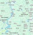
 Sewerskij-Donez-Donbass-Kanal.png 900 × 1,192; 461 KB
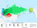 Territorial Expansion of Russia (1300-1945).jpg 700 × 544; 237 KB
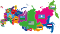
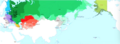 Territorial Expansion of Russian Empire.png 1,288 × 472; 483 KB
 Ukraine Base Map (2024).png 1,104 × 697; 403 KB
 Ukraine's 2023 battle plan to split the Russian forces in half.webp 1,024 × 616; 33 KB
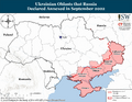
 Ukraines Territorial Changes - 1939-2015.jpg 2,421 × 1,564; 704 KB
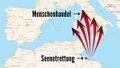 Unterschied zwischen Seenotrettung und Menschenhandel.jpg 1,200 × 675; 145 KB
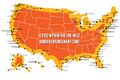 USA - 100-Mile Border Enforcement Zone.jpg 1,200 × 800; 137 KB
 Village Oskil from Izium Raion to Kramatorsk Raion.png 3,135 × 3,584; 5.64 MB


.jpg)


.jpg)
.webp)


.jpg)
.png)


.webp)