File:Historical Map of Ukraine - territories annexed, when and by whom.png
From WikiMANNia Commons

Size of this preview: 800 × 453 pixels. Other resolutions: 320 × 181 pixels | 940 × 532 pixels.
Original file (940 × 532 pixels, file size: 133 KB, MIME type: image/png)
Deutsch: Historische Karte der Ukraine - annektierte Gebiete, wann und von wem
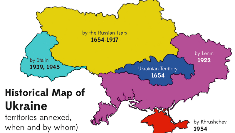
English: Historical Map of Ukraine - territories annexed, when and by whom
File history
Click on a date/time to view the file as it appeared at that time.
| Date/Time | Thumbnail | Dimensions | User | Comment | |
|---|---|---|---|---|---|
| current | 13:00, 17 October 2023 | | 940 × 532 (133 KB) | Werner (talk | contribs) | http://www.cpreview.org/blog/2015/05/identity-theft https://images.squarespace-cdn.com/content/v1/568756ba69492ea07bc25a6d/1478286218131-0HZJW151J5RC3WVK6C8K/Screen-Shot-2015-05-08-at-7.49.42-PM.png |
You cannot overwrite this file.
File usage
There are no pages that use this file.
