File:Oskil Reservoir - Kupjansk - Senkowe - Borowa - Pisky-Radkiwski - Oskil.png
From WikiMANNia Commons

Size of this preview: 562 × 599 pixels. Other resolutions: 225 × 240 pixels | 1,238 × 1,320 pixels.
Original file (1,238 × 1,320 pixels, file size: 1.71 MB, MIME type: image/png)
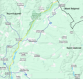
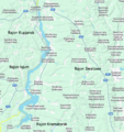
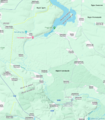
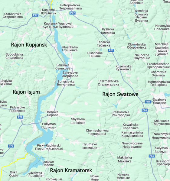
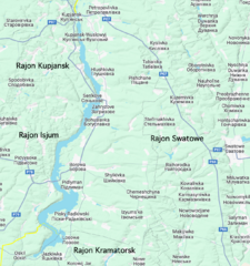
Deutsch: Der Grenzverlauf rechtsseitig des Oskilsker Stausees[wp] von der Kleinstadt Kupjansk[wp] bis zum Dorf Oskil[wp].
Von Kupjansk kommend wechselt die Straße beim Dorf Senkowe[wp], das am rechten Ufer im Rajon Kupjansk[wp] liegt, auf die linke Seite des Stausees.
Die Dörfer Kuryliwka[wp] (3600), Kyslivka[wp] (956), Kruhliakivka[wp] (1173) im Rajon Kupjansk[wp] und Zagryzovo[wp] (544), Bohuslawka[wp] (1300), Borowa[wp] (5300), Pidlyman[wp] (1450) und Pisky-Radkiwski[wp] (2500) im Rajon Isjum[wp] liegen östlich des Stausees und fallen ebenfalls an den Rajon Swatowe[wp] der Volksrepublik Lugansk.English: The border on the right side of the Oskil Reservoir[wp] from the small town of Kupiansk[wp] to the village of Oskil[wp].
Español: La frontera a la derecha del Embalse Oskol[wp], desde la pequeña ciudad de Kúpiansk[wp] hasta el pueblo de Oskil[wp].
- Deutsch
| Neue Grenzlinie |
- English
| New borderline |
- Español
| Nueva línea fronteriza |
[]
- Oskil - Borderline
River Oskil
Oskil Reservoir
Surrounding area of the village of Oskil


File history
Click on a date/time to view the file as it appeared at that time.
| Date/Time | Thumbnail | Dimensions | User | Comment | |
|---|---|---|---|---|---|
| current | 22:51, 15 May 2024 | | 1,238 × 1,320 (1.71 MB) | Admin (Germany) (talk | contribs) |
You cannot overwrite this file.
File usage
The following 4 pages use this file:
